


Trail No.2 Viola Trail - NMK
|
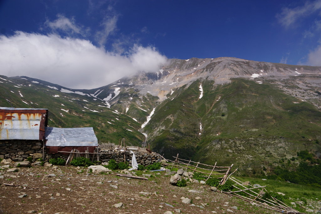
(Mountaineering Hut “Ljuboten” – Bekim’s Sheep Farm – Village of Staro Selo) |
DOWNLOAD GPX POINT OF INTEREST
Positioning - mountain
- Shar Mountain / northeastern segment
Starting point
- Mountaineering Hut “Ljuboten”
Description of the trail
The trail begins from the Mountaineering Hut “Ljuboten”. At the beginning, the trail slightly climbs to the north (about 70 meters in height) and then changes the route to the west/ northwest. It passes along the old tree "Dzandarska Buka". From this place the trail passes under the largest rocky area in Macedonia “Kozja Stena” and descends to Ljubotenska River. From this point, it changes the direction towards southwest and climbs to the Bekim’s Sheep Farm. This trail is one of the most attractive areas of Shar Mountain. It is a combination of pastures, rocky areas and a small portion of forest areas. From the Bekim’s Sheep Farm, which located on "Gradska Livadica", the trail starts to move in the direction to east and descends into the forest belt where it goes from a mountain trail into a wide unpaved road. The road descends towards Ljubotenska Reka, crosses the river from its left bank and moves towards east after which it connects with the road that goes from the village of Staro Selo to the Mountaineering Hut “Ljuboten”. Before the descent to the main unpaved road, a characteristic place is the so-called "Rzhani kamen" - a rock that overhangs the Ljubotenska River. From this point, the trail slightly climbs and merges with the main unpaved road and then descends to the village of Staro Selo.
Technical data:
Altitude at the start point
- Mountain hut “Ljuboten” – 1635 masl
Highest point
- Bekim’s Sheep Farm – 1700 masl
Altitude at the end point
- The village of Rogachevo – 890 masl
Trail duration
- 3.30 – 4.00 hours
Trail length
- 10 km
Altitude gain
- hike up – 255 m
- hike down – 770 m
Trail difficulty
- ☆ ☆ ☆ ☆ ☆
Рequired level of physical fitness
- ☆ ☆ ☆ ☆ ☆
Panoramas and landscapes
When passing the trail starting from "Dzandarska Buka" to the Bekim's Sheep Farm the panoramic view is breathtaking. Towards the north/ northwest and south, we can admire the views of the peak Ljuboten, "Kozja Stena" and its characteristic rock and the Valley of the Ljubotenska River.
From the place called "Rzhani Kamen" the view is more clear, where the dominance of the peak Ljuboten can be experienced and from this point we can also see "Gradska Livadica" and part of the Polog Valley.
Access to the start point
- Motorway Skopje – Tetovo, 43 km
- Local road Tetovo – village of Staro Selo, 25 km
- Unpaved road village of Staro Selo – Mountaineering Hut “Ljuboten”, 7 km (only for 4х4 vehicles)
- Near the Mountaineering Hut “Ljuboten” there is a possibility for parking several vehicles.
Access to the end point:
- Motorway Skopje – Tetovo, 43 km
- Local road Tetovo –village of Staro Selo, 25 km
- In the village of Staro Selo, near the school, which is in the lower part of the village, there is a possibility for parking for several vehicles.
Places of tourism interest
- from the starting point:
- Ljuboten peak - 2.30 hours hiking from the Mountaineering Hut “Ljuboten”
- Lake “Livadichko Ezero” – 3.30 hours hiking form Mountaineering Hut “Ljuboten”
- from the end point
- Lake “Vratnichko Ezero” - 10 minutes driving from village of Staro Selo
- Picnic area “Petacko vodiche“ – village of Belovishte (15 minutes driving from the village of Rogachevo)
- Picnic area “Kalugjer“, village of Rogachevo – 10 minutes driving from the village of Staro Selo
Accommodation and food
- Mountaineering Hut “Ljuboten”, Shar Mountain
- “Vila Ljuboten”, Shar Mountain
- Hostel “Kitka”, Village of Vratnica
- Family house, “Belojshki Biser”, Village of Belovishte
Public transport:
- Public bus, van transport and taxi
Trail No.2 NMK images


GET YOUR MOBILE APP
 |
 |
||
 |
 |
 This web has been produced with the assistance of the European Union. The content of this web is the sole responsibility of the implementing organisations and can in no way be taken to reflect the views of the European Union.