


Trail No.4 Panoramic Trail - NMK

|
(Village of Vejce – Dupnat Kamen Peak) |
DOWNLOAD GPX POINT OF INTEREST
Positioning - mountain
- Shar Mountain, central segment
Starting point
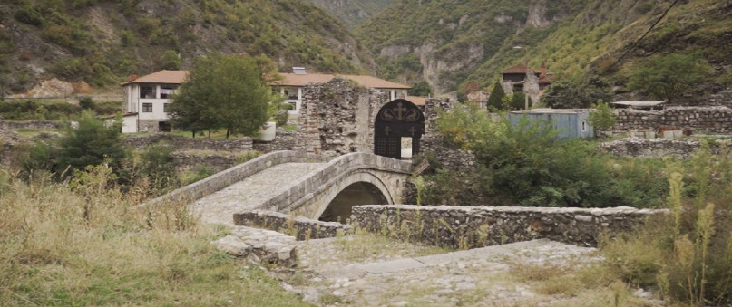
- Village of Vejce
Description of the trail
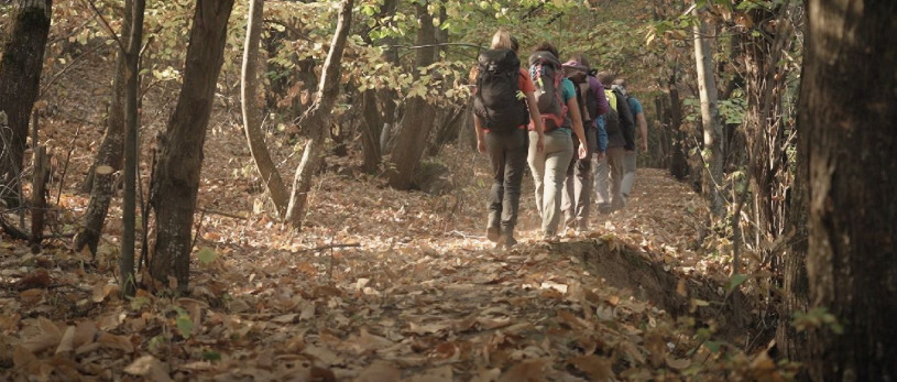
A short trail starting from the bridge at the entrance of the village of Vejce. The village of Vejce is one of the few active villages on the Shar Mountain. From the bridge where the two Dojran rivers and the Kupinica River form the Vejachka River, the trail moves to the north along the right side of the Kupinica River. After 500 metres, we cross an old concrete bridge and start to climb to the peak Dupnat Kamen. Through arable and no longer arable land, the trail goes up to the road that comes from the Village of Selce and leads to the Sheep Farms “Rokopechki Bachila”. To this point, we are heading towards east, after which when we start to move along the road, the direction changes to north. After walking in this direction for 200 metres, a wide meadow appears with a private mountain house on the top side and here the trail again changes the direction towards the east and starts climbing to the saddle between the peaks Dupnat Kamen and Kuchi Baba. After climbing the saddle, towards the south, the climb begins to the peak Dupnat Kamen.
Technical data:
Altitude at the start point
- Village of Vejce – 1130 masl
Highest point
- Dupnat Kamen Peak – 1890 masl
Altitude at the end point
- Dupnat Kamen Peak – 1890 masl
Trail duration
- 2.30 – 3.00 hours
Trail length
- 7 km
Altitude gain
- hike up – 760 m
Trail difficulty
- ☆ ☆ ☆ ☆ ☆
Required level of physical fitness
- ☆ ☆ ☆ ☆ ☆
Panoramas and landscapes
Since the trail takes place on the western slopes of the peak Dupnat Kamen until the peak is reached, the views are in the direction of the west, where you can see the peak Crn Vrv and peak Kobilica.
From the peak Dupnat Kamen the landscape is already much wider and more diverse. To the west, except the peaks Crn Vrv and Kobilica, the Valley of the Vejachka River is beautifully drawn, and the central part of the Shara ridge and the Valley of Leshnica to the southwest. To the south and southeast, the view towards the Polog Valley is open.
Access to the start point
- Motorway Skopje – Tetovo, 43 km
- Local road Tetovo – Village of Vejce, 13 km
- Near the bridge on the entrance in Village of Vejce, there is a possibility for parking of several vehicles.
Access to the end point:
- from the start point:
- Vejce Waterfalls - 2.30 hours hiking from the Village of Vejce
- Crn Vrv Peak – 4.00 hours hiking from the Village of Vejce
- Kobilica Peak – 4.00 hours hiking from the Village of Vejce
Accommodation and food
- Mountaineering hut “Kobilica”, Shar Mountain
- Family house in the Village of Vejce
Public transport:
- Public bus, van transport and taxi
Trail No.4 NMK images


GET YOUR MOBILE APP
 |
 |
||
 |
 |
 This web has been produced with the assistance of the European Union. The content of this web is the sole responsibility of the implementing organisations and can in no way be taken to reflect the views of the European Union.