


Trail No.4 The Roe Deer Trail - KS
DOWNLOAD GPX POINTS OF INTEREST
Positioning - mountain
- Shar Mountain / central region
Starting point
- Restaurant Gold in Mushnikovo Village
Description of the trail
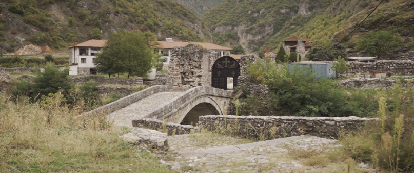
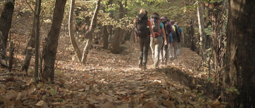
The trail starts from the restaurant Gold above village Mushnikovo that is from regional road R-115. The tourists can fill the bottles with the fresh drinking water from Shar Mountain that is so enjoyable. The trail goes across the river Lumbardhi or Bistrica and along the meadows up to the Gornje Selo. From here the trail splits into two directions. The first one goes through the village on the left side of the river, and following the track one can walk through Prevalla meadows and end up at the recreation center of Prevalla. The other trail goes through the forest above the village on the right side of the river. From there, going uphill, one can quickly gain the altitude difference and can take the southeast direction until it reaches the forest area. The final part of the trail connects to the path within the forest before it ends in the recreation center of Prevalla. This trail is possible to be done as a loop trail within one day.
Technical data:
Starting point altitude:
- 1000 m
Highest point:
- 1515 m/asl
Destination altitude:
- 1515 m/asl
Height difference:
- 515 m
Duration of the tour:
- 3 hours
Length of the tour:
- 8 km
Trail difficulty
- ☆ ☆ ☆ ☆ ☆
Required level of physical fitness
- ☆ ☆ ☆ ☆ ☆
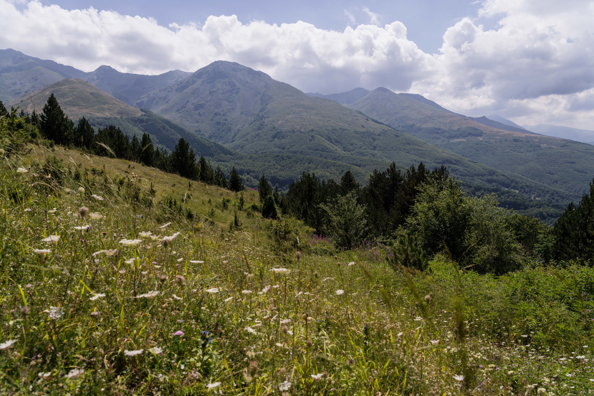
Panoramas and landscapes
- While climbing uphill this trail, panoramic views come being added, surrounded by forests and meadows along the trail.
- If you climb during the fall or winter the trail is more visible, while during the summer it is less visible because it is covered with grass and flowers.
- In some parts of this trail you can also hear the gurgling sounds of the streams and the river.
Access to the start point
- Prishtina – 95 km, Prizren - 17.5 km, Skopje 85 km, Tetovo 90 km and
Tirana 205 km
- Regional road R115 - to Prizren 17.5 km, to Brezovica 22 km
Starting point has parking spaces for vehicles, mini buses.
Access to the end point:
- Regional road R115 to Prizren 29 km, to Brezovica 10.5 km
- There are few parking spaces at the ending point.
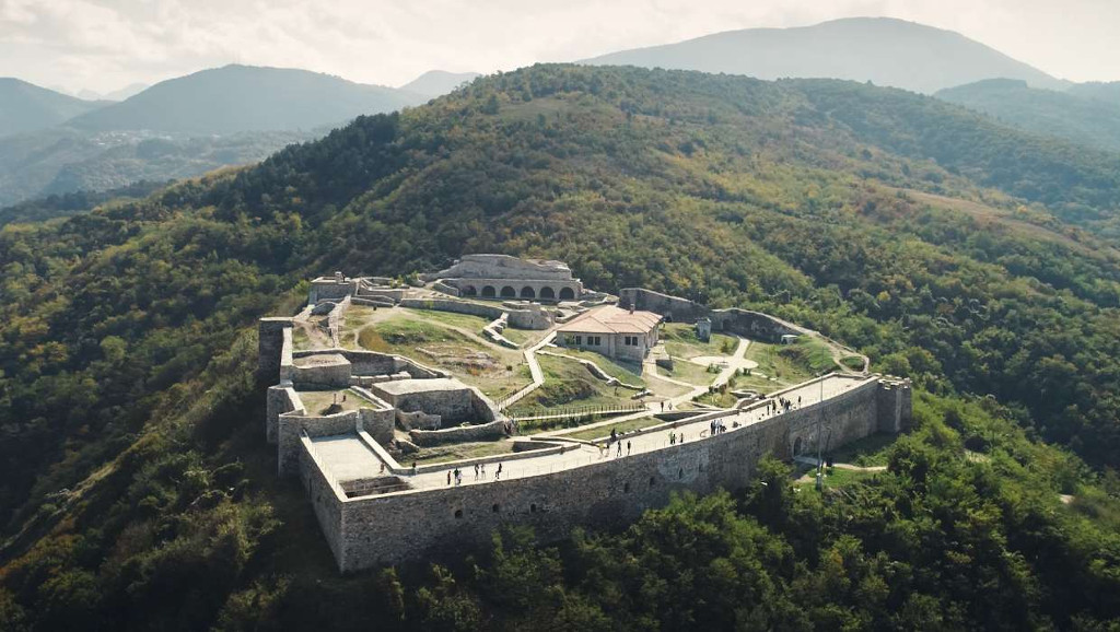
Places of tourism interest
The most interesting parts are the river stream Lumbardhi or Bistrica, the meadows, the forest wild area, ecological area and the wildlife.
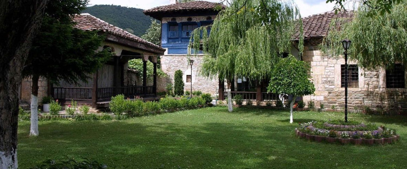
Accommodation and food
- Restaurant Gold – Mushnikovo
- Kulla e Jetimit - Prevalla recreation center
- Hotel Eja, Yjet e Sharrit - Prevalla
- Hotel Sharri – Gornje Selo
- Restaurant Koha - Prevalla
- Hotel Krojet - Prevalla
- Hotel Morea - Prevalla
Public transport:
- Local transport from Prizren to Mushnikovo
Trail No.4 images - KS


GET YOUR MOBILE APP
 |
 |
||
 |
 |
 This web has been produced with the assistance of the European Union. The content of this web is the sole responsibility of the implementing organisations and can in no way be taken to reflect the views of the European Union.