


Cross-border Trail No.11 The Old Trade Trail - KS

DOWNLOAD GPX POINTS OF INTEREST
Positioning – mountain
- Shar Mountain / central segment
Starting point
- Prizren downtown, Shadërvan (Fountain) square
Description of the trail
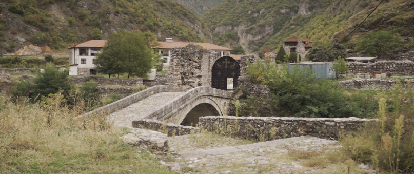
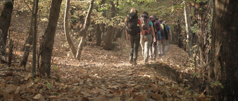
The trail starts from the Sinan Pasha Mosque, which is in the very center of the town, only 50 from Shadërvan fountain square. First part of the trail will go uphill and pass by the Prizren fortress, through the Pine trees along Pasha Qeshme i.e 1, 2 and 3 picnic sites. At this part of the trail the ground is a combination of forest and rocky terrain. Further, the trail continues above village Pousko and goes little downhill up to Jabllanica village, providing the tourist an opportunity to meet local people. Following the Jablanica village, the trail continues inside forest on off-road path, ending at Mountain Hut Shar. From Mountain Hut Shar and further on, the path is flat and very slightly uphill for next 5 kilometers, to the Prislop meadows and Stanet e Struzhës (Karaula-Guard House) and ending at Black peak 1950 meters height.
The last part of the trail from Kosovo Side, continues in very open and scenic trail, with curves and rocky limestone surface, as a horse and mud trail, directed to the big lake (“Liqeni i madh” on Albanian language or “Karanikolicko ezero” on Macedonian language) and Vrtop peak, ending on green - pass of Trade trail. Further downhill it continues to the North Macedonian villages of Bozovce and Veshalla.
Technical and tourist data:
Altitude at the start point
- Prizren city 413 m/asl
Highest point
- Green pass – 2,000 m/asl
Destination altitude
- Cross-border trail through black rock - 1630 m/asl
Height difference
- 1687 m
Duration of the tour
- 6 hours
Length of the tour
- 24 km RKS plus ~ 7 km on RNM side
Trail difficulty
- ☆ ☆ ☆ ☆ ☆
Required level of physical fitness
- ☆ ☆ ☆ ☆ ☆
Panoramas and landscapes:
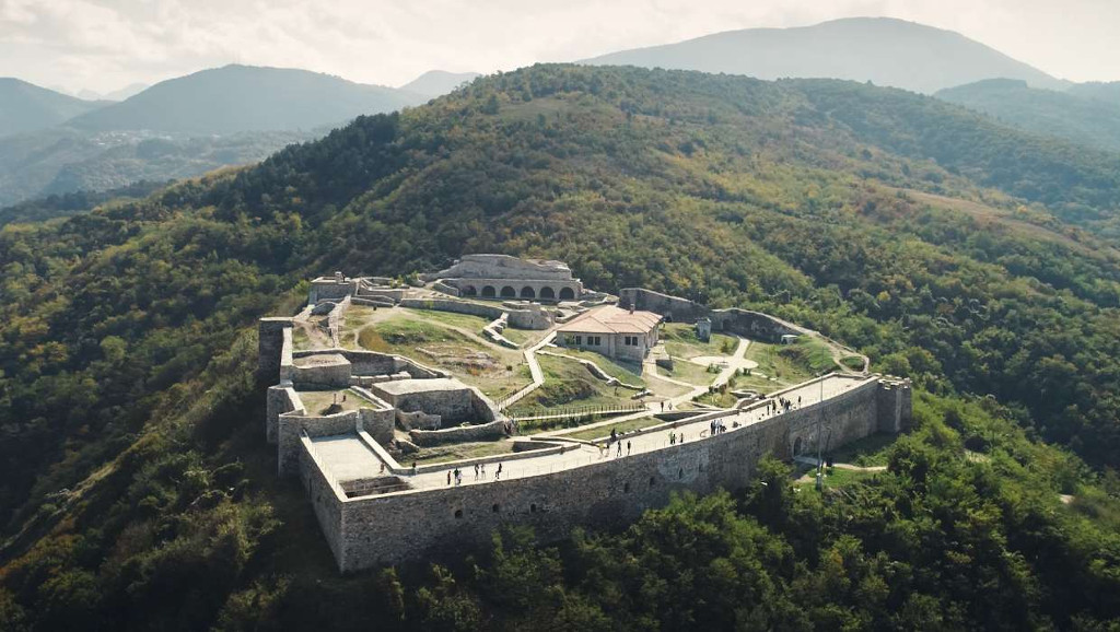
- The start of the trail, gives a very good view from the Prizren fortress and into dense pine forest and chestnut forest, up to the local picnic site.
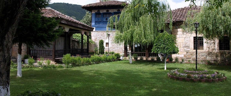
- Further on, the trail has also panoramic view to the local villages and their appearance as a whole, from where it goes into the oak tree and continues before the Karaula or “Stanet e Struzhes”.
- The last stage of the trail, has an open and very panoramic view form 180° to 360° from where one can see the Zupa valley, Opoja and mountains of Pastrik, Korritnik on west and Scarpa, Lake Peak on the south and Vrtop and Oshljak Peak on the southeast.
Access to starting point:
- Highway Prishtina Airport 70 km, Skopje 100 km, Tirana 220 km
- Local road Brezovica – Prizren 50 km (R115)
- Off-road from the Prizren to – Mountain lodge “Shar”, 12 km of the trail and Mountain cabin Stanet e struzhes 16 km (accessible for 4x4 vehicles), car, minibuses
- There are several parking spaces for terrain vehicles, near the mountain lodge-cabin
Prizren city has parking spaces for a larger number of vehicles.
Access to the ending point:
- Highway Skopje – Tetovo, 43 km
- Local road Tetovo – Bozovce 23 km
There are several parking spaces in villages.
Places of touristic interest:
- Prizren Fortress - 15 minutes walking from the starting point
- Pasha qeshme - 1 hour walking from the starting point
- Jabllanica village panoramic view - 2 hours walking from the starting point
- Mountain hut Shar - 3 hours walking from the starting point
- Guri i zi - 4 hours and 30 minutes walking from the starting point
- Green pass – 6 hours and 30 minutes walking from the starting point
Accommodation and food
- Mountain lodge “Shar” on 16th km of the trail
- Mountain cabin “Stanet e struzhës” close to black rock on the 20th km of the trail
- Villages Struzhe, Zaplluzhe from Kosovo side an in Macedonian side villages Veshalla and Bozovce
Public transport:
- There is a Public transport to the starting point from Prishtina every day, from Skopje it is 10 euro and from Tirana it is 10 euro (every day two time during working days). Taxi transport to the starting point from Prishtina is 40 euro, from Skopje is 50 euro and from Tirana is 60 euro per car.
Trail No.11 KS images


GET YOUR MOBILE APP
 |
 |
||
 |
 |
 This web has been produced with the assistance of the European Union. The content of this web is the sole responsibility of the implementing organisations and can in no way be taken to reflect the views of the European Union.